
Active Transportation
Active Transportation Plan
MACOG completed the Active Transportation Plan in 2016 to identify needs, resources, and strategies to improve and increase walking and bicycling in the region. As a result, the Active Transportation Plan includes an inventory of existing trails and pathways, a list of proposed projects, a proposed project map, and several steps to take towards improvement.
The regularly updated Long Range Plan for the MACOG region also includes Active Transportation projects to ensure they are represented during decision making for project budgeting and funding. This ensures projects are evaluated, updated and appropriately prioritized for implementation.

Complete Streets Policy
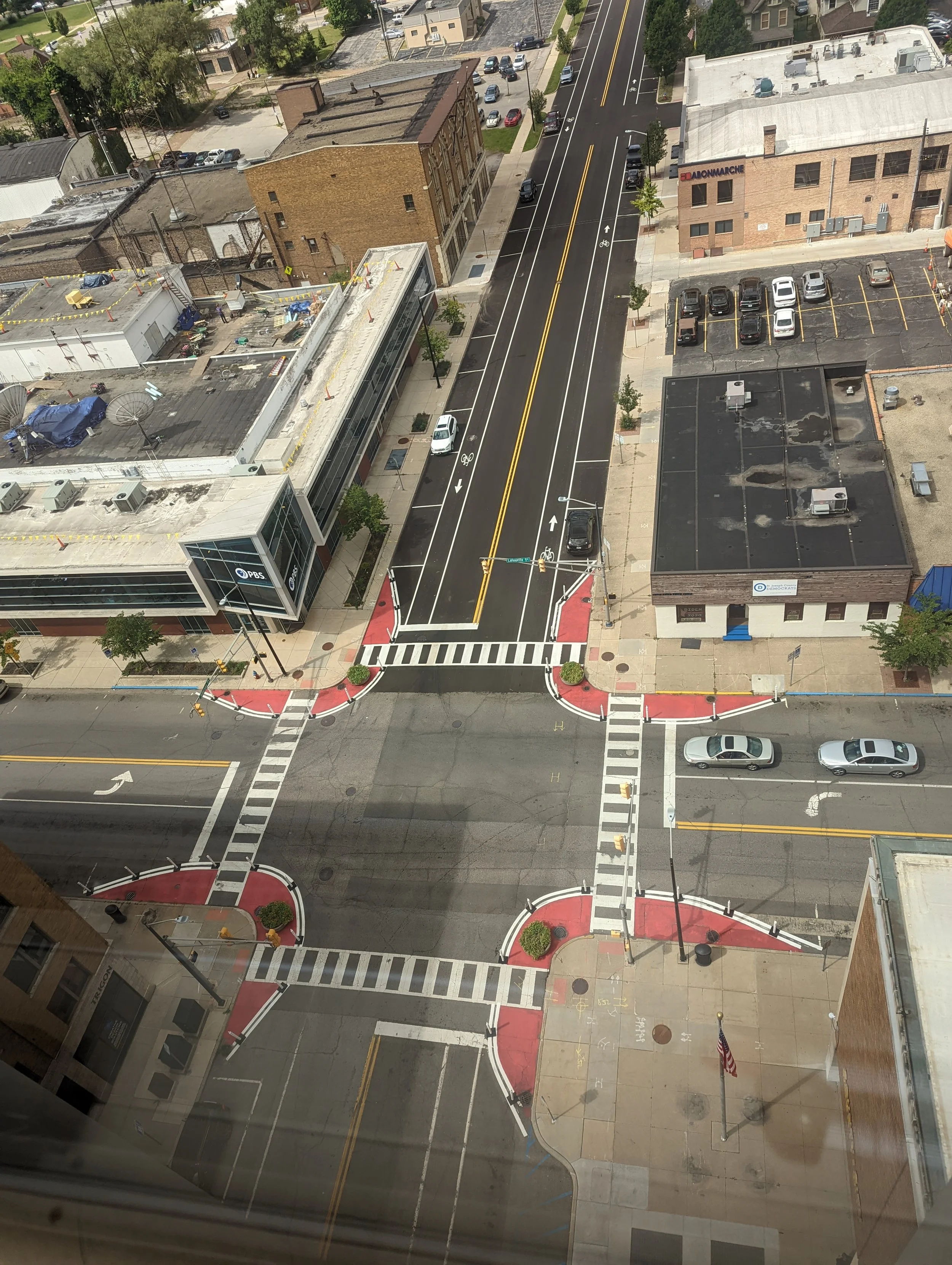
MACOG recognizes the importance of increasing accessibility, safety, and equity for all users through multimodal streets. In 2019, MACOG adopted a Regional Complete Streets Policy to guide projects receiving funds allocated for transportation projects in the South Bend and Elkhart-Goshen Urbanized Area.
Complete Streets benefit residents, business owners, developers, and communities as a whole by creating an environment that’s comfortable and attractive for all modes of transportation and users. Multimodal environments improve both the quality of life and public health of a community by encouraging and enabling a healthy lifestyle and reduced emissions by offering active and sustainable transportation options.
Crossway Trails
Joseph, Elkhart, Marshall, and Kosciusko Counties in Indiana and extending into Michigan. Check out the Crossway Trails website for more information, trail events and updates, and check out the Crossway Trails Map to find a trail to explore in the region!
Crossway Trails Condition Report
MACOG is applying a roadway-style asset management approach to trails and pathways, recognizing their importance as regional assets. MACOG developed a "Data Bike" system using a smartphone and cameras to collect data on trail surface roughness and condition. This data, presented as a "good-average-poor" visualization along with geolocated photos, helps:
Systematically evaluate and inventory trail conditions.
Identify areas needing maintenance.
Analyze the causes of deterioration.
Estimate the costs of repairs.
SAFE ROUTES TO SCHOOL
Safe Routes to School is a national initiative aimed at encouraging more kids to walk and bike to school by making it safe, convenient, and fun. MACOG has been working towards this through advocating for more active transportation infrastructure and encouraging walking and biking by creating fun Safe Routes to School flyers and activity calendars to be distributed to schools.
SAFETY GUIDE
It’s on all of us to keep other walkers, bikers, and drivers safe while on the roads. This means keeping your eyes on the road, staying visible, and watching out for other users. Check out the Walk and Ride Safety Guide for more ways to keep yourself and others safe.
ACCESSIBILITY
The MACOG region boasts more than 800 miles of trails, bike lanes, and bicycle routes. MACOG continues to foster a region-wide commitment to accessible and efficient active transportation. In 2016, the Active Transportation Plan was adopted into Michiana on the Move: 2040 Transportation Plan. This plan identified needs and resources to improve and increase walking and bicycling in the region and serves as a comprehensive strategy to ensure that all users of the transportation network are able to move around in a safe, connected, and accessible environment.