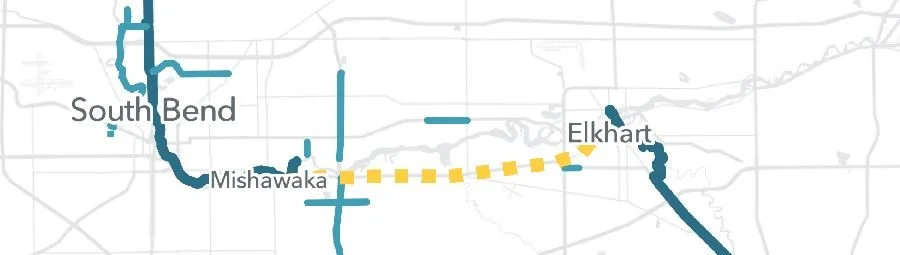
MACOG Awarded Federal Planning Grant to close 11-mile Mishawaka to Elkhart Gap
The U.S. Department of Transportation (USDOT) announced that the Michiana Area Council of Governments (MACOG) will receive $816,800 from the Rebuilding American Infrastructure with Sustainability and Equity (RAISE) program for a project “Connecting the Crossway Trails Spine: Mishawaka to Elkhart Trail.” The project will plan a multi-use trail that will fill an 11-mile gap of the Crossway Trails between the Mishawaka Riverwalk and the Elkhart Riverwalk through St. Joseph and Elkhart Counties.
This project includes a planning & engineering study to find a preferred route for the path. Planning activities include public engagement, alternatives analysis, preferred alignment, implementation, funding, and up to 30 percent design on priority segments. It will also evaluate electric vehicle charging stations and docking stations for bike share at trailheads, as well as transit connections to the trail.
“This is an important first step toward connecting the South Bend/Mishawaka trails and the Elkhart trails as part of the Crossway Trails system. If we can build this 11 mile gap, our region would have a fully connected 58-mile multi-use trail,” said James Turnwald, Executive Director or MACOG.
MACOG’s grant is part of the USDOT announcement of $1.8 billion in awards from the RAISE grant program for 148 projects across the country. The competitive and popular program supports projects of local and regional significance. Funding is split equally between urban and rural areas, and a large percentage of grants support regions defined as historically disadvantaged or areas of persistent poverty. The eligibility requirements of RAISE allow project sponsors to pursue multi-modal and multi-jurisdictional projects that are more difficult to fund through other grant programs. As in years past, the demand for RAISE funding outpaced available funds, with the Department receiving almost $13 billion in requests.
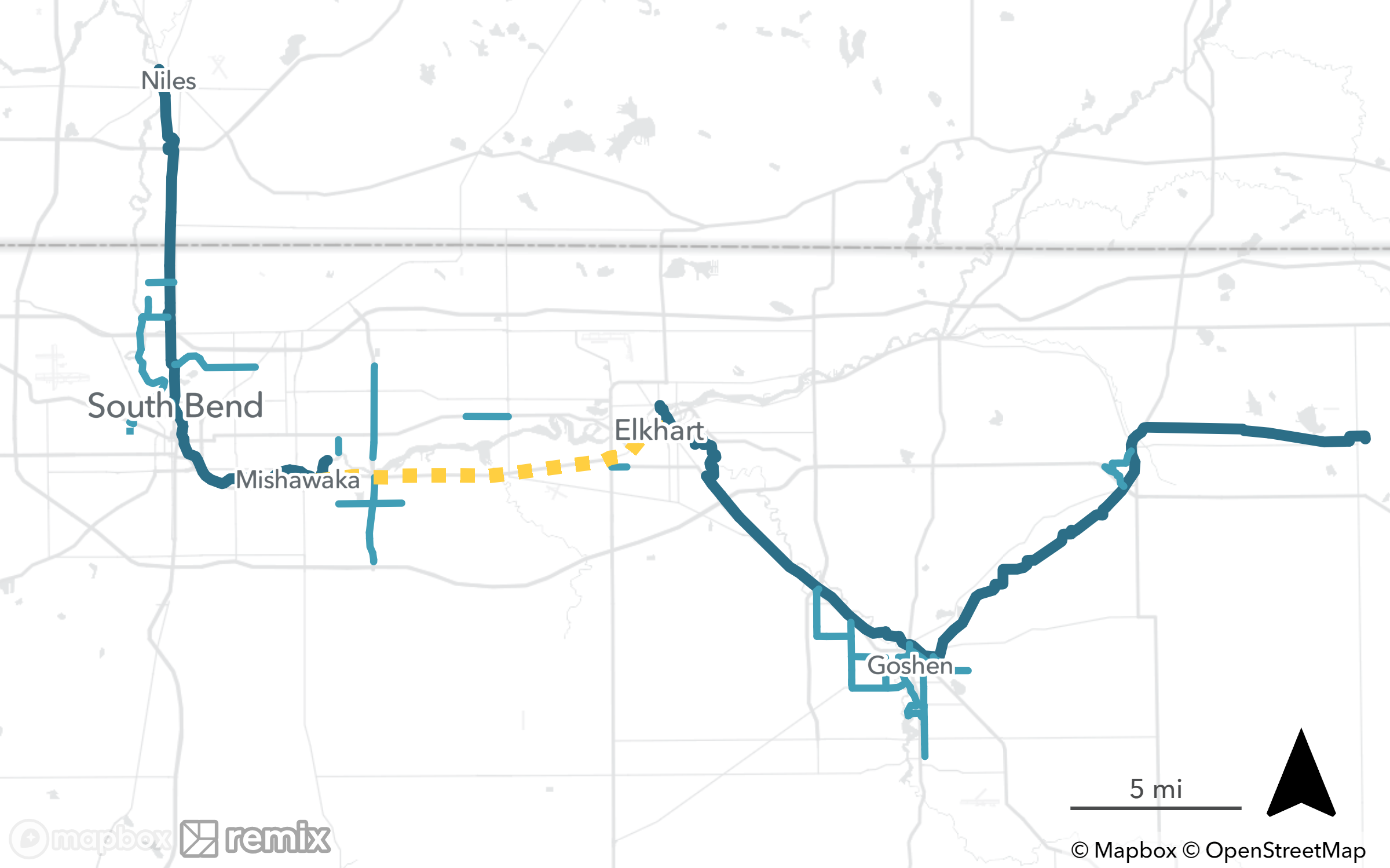
A Crossway Trail system map showing the 11-mile gap in dotted yellow.
About Crossway Trails:
The Crossway Trails is a growing regional trail network working to connect families, commuters, and visitors across Northern Indiana and Southwestern Michigan to improve health, safety, quality of life, and mobility for all.
For more information visit www.crosswaytrails.com.